PUR Watershed Assessments
-----------------------------------------------------------------------------------------------------------------------------------------------------
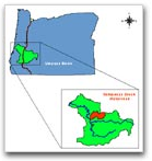
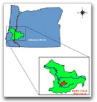
Calapooya Creek Watershed Assessment and Action Plan
The Purpose of the Watershed Assessment and Action Plan
The Calapooya Creek Watershed is 157,282 acres. The City of Oakland is entirely within the watershed boundary. The northwestern section of Sutherlin is also within the Calapooya Creek Watershed. The most common land use in the Calapooya Creek Watershed is forestry, with 64% of the land base used for public or private forestry. Agriculture constitutes 33% of the land use, and mostly occurs in the western half of the watershed. Land ownership is primarily private (91%), with public ownership mostly administered by the Bureau of Land Management.
Download the entire report in PDF format
-----------------------------------------------------------------------------------------------------------------------------------------------------
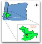
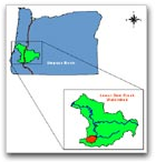
Deer Creek Watershed Assessment and Action Plan
The Purpose of the Watershed Assessment and Action Plan
The Deer Creek Watershed consists of the eastern portion of the Lower South Umpqua River fifth-field watershed, and is 43,090 acres. The eastern portion of the City of Roseburg is within the Deer Creek Watershed, as is the Dixonville population center.
Download the entire report in PDF format
-----------------------------------------------------------------------------------------------------------------------------------------------------
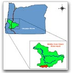
Middle Cow Creek Watershed Assessment and Action Plan
The Purpose of the Watershed Assessment and Action Plan
The Middle Cow Creek Watershed is 113,023 acres. The watershed begins at Galesville Dam and continues 34 miles downstream to the confluence of Cow Creek and Middle Creek. The watershed contains the city of Glendale, which is 22 miles north of Grants Pass near Interstate Five. About half of the watershed (52%) is in private ownership, including most of the property along Cow Creek, and intermixed throughout the uplands among government lands. The federal ownership is 39%, mainly belonging to the BLM.
Download the entire report in PDF format
-----------------------------------------------------------------------------------------------------------------------------------------------------
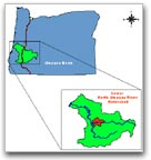
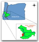
Lower Cow Creek Watershed Assessment and Action Plan
The Purpose of the Watershed Assessment and Action Plan
The Lower Cow Creek Watershed is 102,537 acres. Riddle is the only incorporated city within the watershed. The most common land use in the Lower Cow Creek Watershed is forestry, with 91% of the land base used for public or private forestry. Agriculture constitutes 6% of the land use, and mostly occurs around Riddle. Land ownership is primarily private (60%).
Download the entire report in PDF format
Open EPA Region 10's Formosa Mine Cleanup Page
-----------------------------------------------------------------------------------------------------------------------------------------------------
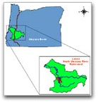
Lower North Umpqua Watershed Assessment and Action Plan
The Purpose of the Watershed Assessment and Action Plan
The Lower North Umpqua fifth-field watershed is 106,260 acres. The City of Sutherlin is the only incorporated city that is mostly within the watershed. Other population centers include Wilbur, Winchester, and Glide. Land use in the watershed is primarily agriculture (54%) and forestry (34%). Residential properties account for less than 10% of the total watershed, but are a dominant land use along the North Umpqua River.
Download the entire report in PDF format.
Download the entire Addendum in PDF format
-----------------------------------------------------------------------------------------------------------------------------------------------------
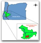
Lower South Umpqua Watershed Assessment and Action Plan
The Purpose of the Watershed Assessment and Action Plan
The Lower South Umpqua Watershed is 110,419 acres. The eastern-most section of this watershed was assessed by the PUR in the Deer Creek Watershed Assessment and Action Plan. Therefore, this assessment focuses only on the western portion of this watershed, which is 67,329 acres. Most of the City of Roseburg and all of the City of Winston are within the Lower South Umpqua Watershed, as well as the population areas of Green, Shady, and Melrose. Land ownership is primarily private (94%).
Download the entire report in PDF format
-----------------------------------------------------------------------------------------------------------------------------------------------------
Middle South Umpqua Watershed Assessment and Action Plan
The Purpose of the Watershed Assessment and Action Plan
The Middle South Umpqua Watershed is 59,441 acres. There is no incorporated city that is entirely within the watershed. A small portion of western Myrtle Creek falls within the watershed boundary, as do all of the Dillard and Tri-City areas. Over half of the land base within the Middle South Umpqua Watershed is used for forestry. Agriculture lands account for almost 40% of the watershed. Land ownership is primarily private (84%).
Download the entire report in PDF format
-----------------------------------------------------------------------------------------------------------------------------------------------------
Myrtle Creek Watershed Assessment and Action Plan
The Purpose of the Watershed Assessment and Action Plan
The Myrtle Creek Watershed is 76,322 acres. There are no highways within the watershed, and the only population center is the City of Myrtle Creek. The most common land use in the Myrtle Creek Watershed is forestry, with over 79% of the land base used for public or private forestry. Agriculture constitutes 18%, and mostly occurs in valleys. Land ownership is primarily private (57%).
Download the entire report in PDF format
-----------------------------------------------------------------------------------------------------------------------------------------------------
Olalla/Lookingglass Watershed Assessment and Action Plan
The Purpose of the Watershed Assessment and Action Plan
The Olalla/Lookingglass Watershed is 103,000 acres. The nearest incorporated city is Winston, just east of the watershed. Rural residential areas within the watershed include Lookingglass, Tenmile, Olalla, and Reston. The most common land use in the Olalla/Lookingglass Watershed is forestry, with 76% of the land base used for public or private forestry. Agriculture constitutes 19% of the watershed. Land ownership is primarily private (72%).
Download the entire report in PDF format
-----------------------------------------------------------------------------------------------------------------------------------------------------
South Umpqua River Watershed Assessment and Action Plan
The Purpose of the Watershed Assessment and Action Plan
The South Umpqua River Watershed is 141,575 acres. The City of Canyonville is the only incorporated city within the watershed; other population centers are Days Creek and Milo. The most common land use in the South Umpqua River Watershed is forestry, with 89% of the land base used for public or private forestry. Agriculture constitutes 9% of the land use, and mostly occurs in and around the South Umpqua River and Days Creek floodplains. Land ownership is primarily private (55%).
Download the entire report in PDF format
-----------------------------------------------------------------------------------------------------------------------------------------------------
Tiller Region Watershed Assessment and Action Plan
The Purpose of the Watershed Assessment and Action Plan
The Tiller Region Watershed is 151,137 acres. The region stretches a maximum of 26.1 miles north to south and 14.7 miles east to west. The Tiller Trial Highway and the South Umpqua River Road are major roads within the region. The only population centers are Tiller and Drew. Tiller is located at the confluence of the South Umpqua River and Elk Creek. Drew is located near Camp Creek, between Drew Creek and Joe Hall Creek. Land use in the Tiller Region is approximately 98% forestry. Agricultural lands, residential developments, and commercial developments constitute approximately 2% of the land base. Approximately 75% of the Tiller Region is federal land. The BLM administers the federal lands in the Deadman Creek and Dompier Creek drainages; the US Forest Service administers the rest. Approximately 25% of the Tiller Region is privately owned. Douglas County and the State of Oregon each administer less than 1% of the total land base.
Download the entire report in PDF format
-----------------------------------------------------------------------------------------------------------------------------------------------------
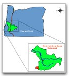
West Fork Cow Creek Watershed Assessment and Action Plan
The Purpose of the Watershed Assessment and Action Plan
The West Fork Cow Creek Watershed is 55,914 acres. There are no highways and no cities or population centers within the watershed. According to data from the 2000 US Census, the population of the West Fork Cow Creek Watershed is zero. Forestry is the only land use within the West Fork Cow Creek Watershed. Land ownership is primarily federal (53%).
Download the entire report in PDF format
-----------------------------------------------------------------------------------------------------------------------------------------------------
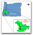
Rock Creek Region Watershed Assessment and Action Plan
The Purpose of the Watershed Assessment and Action Plan
The Rock Creek Region includes the Rock Creek Watershed, Canton Creek Watershed, and just under half of the Middle North Umpqua Watershed. The entire region is 154,215 acres located mostly in Douglas County, Oregon, with a smaller northeast portion of the Canton Creek Watershed in Lane County. The most common land use in the Rock Creek Region is forestry, with 55 percent of the land base used for public or private forestry. Land ownership is primarily public (64 percent) with the majority managed by the Roseburg District, Bureau of Land Management (BLM) and the rest by the Umpqua National Forest.
Download the entire report in PDF format
-----------------------------------------------------------------------------------------------------------------------------------------------------
Upper Cow Creek Watershed Assessment and Action Plan
The Purpose of the Watershed Assessment and Action Plan
The Upper Cow Creek fifth-field watershed is located in Douglas County, Oregon, and is 47,482.5 acres. There are no incorporated cities within the watershed. Galesville Reservoir is in the northwestern corner of the watershed. The Upper Cow Creek Watershed consists of 20.3 stream miles of Cow Creek above Galesville Dam. The most common land use in the Upper Cow Creek Watershed is forestry, with 98.7% of the land base used for public or private forestry. Agriculture constitutes 1.2% of the land use, and mostly occurs along Cow Creek. Land ownership is primarily federal (67.0%) and is mostly administered by the USDA Forest Service and USDI Bureau of Land Management. Private landholdings constitute 24.9% of the watershed.
Download the entire report in PDF format
-----------------------------------------------------------------------------------------------------------------------------------------------------
Lower Umpqua River Watershed Assessment and Action Plan
The Purpose of the Watershed Assessment and Action Plan
The Lower Umpqua River Watershed is a 67,930-acre area in the Umpqua River sub-basin that extends from the mouth of the Umpqua River upstream to the confluence of Mill Creek, just below Scottsburg, and all tributary streams that drain into the Umpqua River in between. The watershed stretches a maximum of 7 miles north to south and 18 miles east to west. Reedsport, Gardiner, and Winchester Bay, all located in the lower portion of the watershed, are the only population centers within the watershed. Reedsport is the only incorporated city. The most common land use in the Lower Umpqua River Watershed is forestry, with about 69% of the land base being forested. Much of the forested land is used for public or private forestry. Agriculture constitutes about 3% of the land use.
Download the entire report in PDF format
-----------------------------------------------------------------------------------------------------------------------------------------------------
Middle Umpqua River Watershed Assessment and Action Plan
The Purpose of the Watershed Assessment and Action Plan
The Middle Umpqua River Watershed is a 63,505-acre area in the Umpqua River sub-basin that drains into the Umpqua River between the confluence with Mill Creek, just below Scottsburg, upstream to the confluence with Elk Creek, just above Elkton. The watershed stretches a maximum of 9 miles north to south and 17 miles east to west. The communities of Elkton, Scottsburg, and Wells Creek are the only population centers within the watershed. The most common land use in the Middle Umpqua River Watershed is forestry, with about 78% of the land base being forested. Much of the forested land is used for public or private forestry. Agriculture constitutes about 8% of the land use.
Download the entire report in PDF format
-----------------------------------------------------------------------------------------------------------------------------------------------------
Upper Umpqua River Watershed Assessment and Action Plan
The Purpose of the Watershed Assessment and Action Plan
The Upper Umpqua River Watershed is a 169,676-acre area in the Umpqua River sub-basin that drains into the Umpqua River from the confluence with Elk Creek upstream to the confluence with the North and South Umpqua rivers (also known as River Forks). The Upper Umpqua Watershed stretches a maximum of 27 miles north to south and 12 miles east to west. Within the Upper Umpqua River Watershed, private lands are interspersed with federal lands throughout the watershed. The majority of the Upper Umpqua River Watershed is forested (approximately 70%). Agriculture constitutes about 16% of the land use, and mostly occurs in the floodplains of the lower Umpqua River and its tributary streams Mill Creek and Rock Creek.
Download the entire report in PDF format
-----------------------------------------------------------------------------------------------------------------------------------------------------
Mill Creek Watershed Assessment and Action Plan
The Purpose of the Watershed Assessment and Action Plan
The Mill Creek Watershed is a 86,039-acre area in the Umpqua River sub-basin that drains into the Umpqua River just below Scottsburg. The watershed stretches a maximum of 21 miles north to south and 10 miles east to west. The watershed contains Loon Lake, Loon Lake Recreation Area, and Ash Valley. Ash Valley is the only population center within the watershed. The most common land use in the Mill Creek Watershed is forestry, accounting for 85.8% of the watershed. Much of the forested land is used for public or private forestry. Agricultural and livestock use constitutes only about 2.2% of the land use, and mostly occurs in the floodplains of Lake Creek.
Download the entire report in PDF format
-----------------------------------------------------------------------------------------------------------------------------------------------------